


Argentina road trip map
245 places from the Puna to Tierra del Fuego, organized into 8 regions, with the towns to refuel in, the isolated gas stations and the border crossings. On your phone with no signal, and in a mini guide to plan with.
- Instant download
- Works offline
- Free updates
Explore Argentina by region
Pick a region and tap a large dot to see that must-see.
Northwest
Quebrada de Humahuaca, Salta, the Calchaquí Valleys and the Puna.
- 13 parks and nature
- 13 towns and cities
- 8 viewpoints and scenic drives
- 5 mountains, volcanoes and glaciers
- 5 culture and history
- 4 base towns
Must-sees in this region
- Los Cardones National ParkProtected area in Salta that preserves more than 64,000 hectares of mountain ecosystems and cardón cactus forests.
- Quebrada de las ConchasLandscape with colorful rock formations in unusual shapes.
- Quebrada de HumahuacaMountain valley with unique landscapes and cultural heritage.
- Serranía de Hornocal (Mountain of 14 Colors)Mountain range with 14 zigzag bands of color, at about 4,350 m. Reached on 25 km of gravel road from Humahuaca.
- Salinas GrandesVast salt flats in a striking desert landscape.
- PurmamarcaColorful village near the Cerro de los Siete Colores.
- CachiPicturesque village in the Valles Calchaquíes, known for its mountain scenery and its food.
- CafayateKnown for its wines, especially Torrontés, and its mountain and valley landscapes.
- Pucará de TilcaraRuins of a pre-Columbian fortress in the Quebrada de Humahuaca.
- Paso de JamaBorder pass at 4,200 m that connects Jujuy with San Pedro de Atacama, crossing the Puna and the Andes.
- Cuesta del ObispoWinding road that connects the Lerma Valley with the upper Calchaquí Valley, with spectacular views.
Plus 42 more places in this region, each with its number on the mini guide map.
Litoral and Chaco
Iguazú, the Iberá Wetlands, the Jesuit missions and the Chaco.
- 7 parks and nature
- 4 lakes, rivers and waterfalls
- 1 culture and history
- 1 base towns
Must-sees in this region
- Iguazú FallsHuge waterfalls on the border with Brazil, a World Heritage Site.
- Esteros del IberáPristine wetlands in Argentina, home to rich biodiversity and striking landscapes.
Plus 11 more places in this region, each with its number on the mini guide map.
Cuyo
Mendoza, Aconcagua, Talampaya and Ischigualasto.
- 4 parks and nature
- 3 towns and cities
- 2 lakes, rivers and waterfalls
- 2 food and markets
- 2 base towns
- 1 mountains, volcanoes and glaciers
Must-sees in this region
- Talampaya National ParkCanyons with red walls up to 150 m high, petroglyphs and fossil remains. World Heritage Site together with Ischigualasto.
- Ischigualasto Provincial ParkGeological park with unique rock formations.
- Cañón del AtuelSpectacular canyon carved by the river, good for rafting and adventure tourism.
- AconcaguaThe highest mountain in South America, popular with mountaineers and hikers.
Plus 11 more places in this region, each with its number on the mini guide map.
Buenos Aires and the Pampas
Buenos Aires, Córdoba, the Buenos Aires coast and the sierras.
- 20 culture and history
- 14 towns and cities
- 8 parks and nature
- 4 base towns
- 2 food and markets
- 1 lakes, rivers and waterfalls
Some places in this region
- Museo de Arte Latinoamericano de Buenos AiresMALBA, the Latin American art museum in Palermo, with works by Frida Kahlo, Diego Rivera and Xul Solar.
- Microcentro de Buenos AiresHistoric and financial center of Buenos Aires, with Plaza de Mayo, the Casa Rosada and Florida Street.
- Parque CentenarioCircular urban park at the geographic center of Buenos Aires, with a lake and a neighborhood feel.
- Recoleta CemeteryHistoric cemetery known for its mausoleums and the tombs of famous Argentines, such as Eva Perón.
Plus 45 more places in this region, each with its number on the mini guide map.
Andean Patagonia: lakes and forests
Bariloche, the Seven Lakes, El Bolsón and the parks of Neuquén and Chubut.
- 18 lakes, rivers and waterfalls
- 12 parks and nature
- 9 mountains, volcanoes and glaciers
- 9 towns and cities
- 4 beaches, coasts and islands
- 4 viewpoints and scenic drives
Must-sees in this region
- Lanín National ParkNational park in Patagonia, good for those who love untouched nature and outdoor activities.
- Nahuel Huapi National ParkLarge park in Patagonia with forests, mountains and clear lakes.
- Los Alerces National ParkNatural park with ancient forests and lake and mountain scenery, good for hiking and exploring.
- Seven Lakes RouteScenic road that passes seven Andean lakes.
- Circuito ChicoScenic loop around San Carlos de Bariloche, good for exploring the landscape of the region.
Plus 60 more places in this region, each with its number on the mini guide map.
Patagonian coast
Península Valdés, penguin colonies and Route 3 along the Atlantic.
- 7 parks and nature
- 6 towns and cities
- 5 beaches, coasts and islands
- 3 base towns
- 2 culture and history
- 1 lakes, rivers and waterfalls
Must-sees in this region
- Península ValdésMarine wildlife reserve, with whales and penguins.
- Punta TomboLarge Magellanic penguin colony on the Chubut coast. Entry fee.
Plus 23 more places in this region, each with its number on the mini guide map.
Southern Patagonia and glaciers
El Calafate, Perito Moreno, El Chaltén and the southern Route 40.
- 5 mountains, volcanoes and glaciers
- 4 lakes, rivers and waterfalls
- 4 base towns
- 2 parks and nature
- 2 viewpoints and scenic drives
- 1 towns and cities
Must-sees in this region
- Los Glaciares National ParkPark with glaciers, mountains and the famous Perito Moreno.
- Mount Fitz RoyIconic mountain in Los Glaciares National Park, popular with climbers.
- Cerro TorreIconic mountain in Los Glaciares National Park, known for its shape and how hard it is to climb.
- Perito Moreno GlacierOne of the best-known glaciers in the world, in Los Glaciares National Park.
- Laguna de los TresLake in Los Glaciares National Park, next to Fitz Roy. It is 25 km round trip and takes 8 hours (at a brisk pace). Difficulty is medium-high, especially the final climb.
- El ChalténVillage in Los Glaciares National Park. A striking natural setting with many varied options for hiking, climbing, excursions and walks.
- Cueva de las ManosRock paintings of hands about 9,000 years old above the Pinturas River canyon, a World Heritage Site.
Plus 12 more places in this region, each with its number on the mini guide map.
Tierra del Fuego
Ushuaia, the Beagle Channel and the end of Route 3.
- 6 mountains, volcanoes and glaciers
- 5 parks and nature
- 5 lakes, rivers and waterfalls
- 4 culture and history
- 4 viewpoints and scenic drives
- 2 base towns
Must-sees in this region
- Tierra del Fuego National ParkPark at the end of the world with mountains and coastline.
- End of National Route 3The end point of the road at Bahía Lapataia, inside Tierra del Fuego National Park.
Plus 26 more places in this region, each with its number on the mini guide map.
Must-seeOther place
What's on the map
267 places in 11 categories, each one a layer in your maps app.
- Parks and nature58
- Towns and cities47
- Lakes, rivers and waterfalls38
- Culture and history35
- Mountains, volcanoes and glaciers26
- Base towns22
- Viewpoints and scenic drives19
- Beaches, coasts and islands9
- Food and markets8
- Hot springs4
- Deserts and salt flats1
Inside the mini guide
27 pages with a map for each region, for your phone or to print.
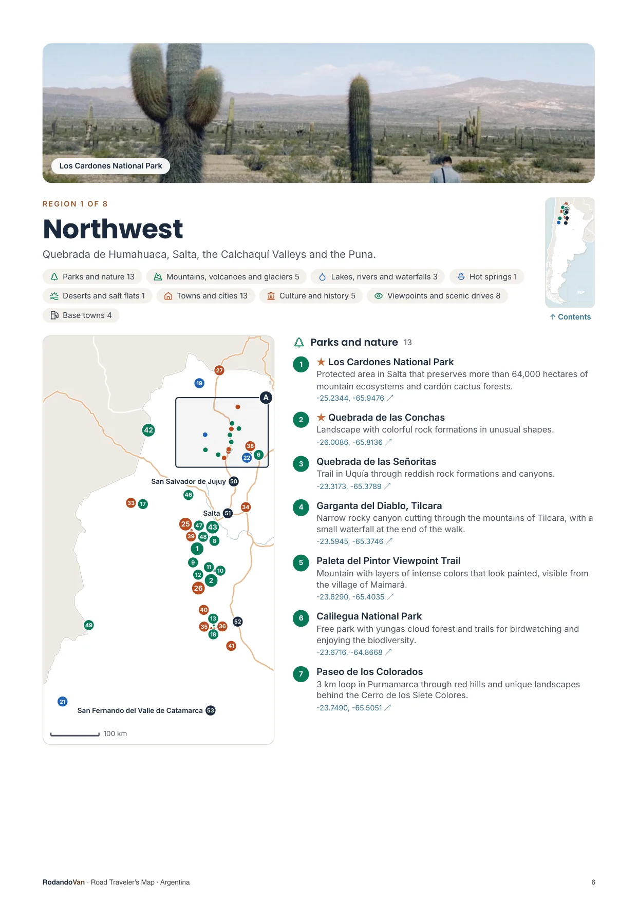
A map for each region, with every place numbered
- The number is the same on the map, in the list and in the phone file.
- Where many places are close together, a separate detail map.
- The coordinates open the place in Google Maps from the PDF.
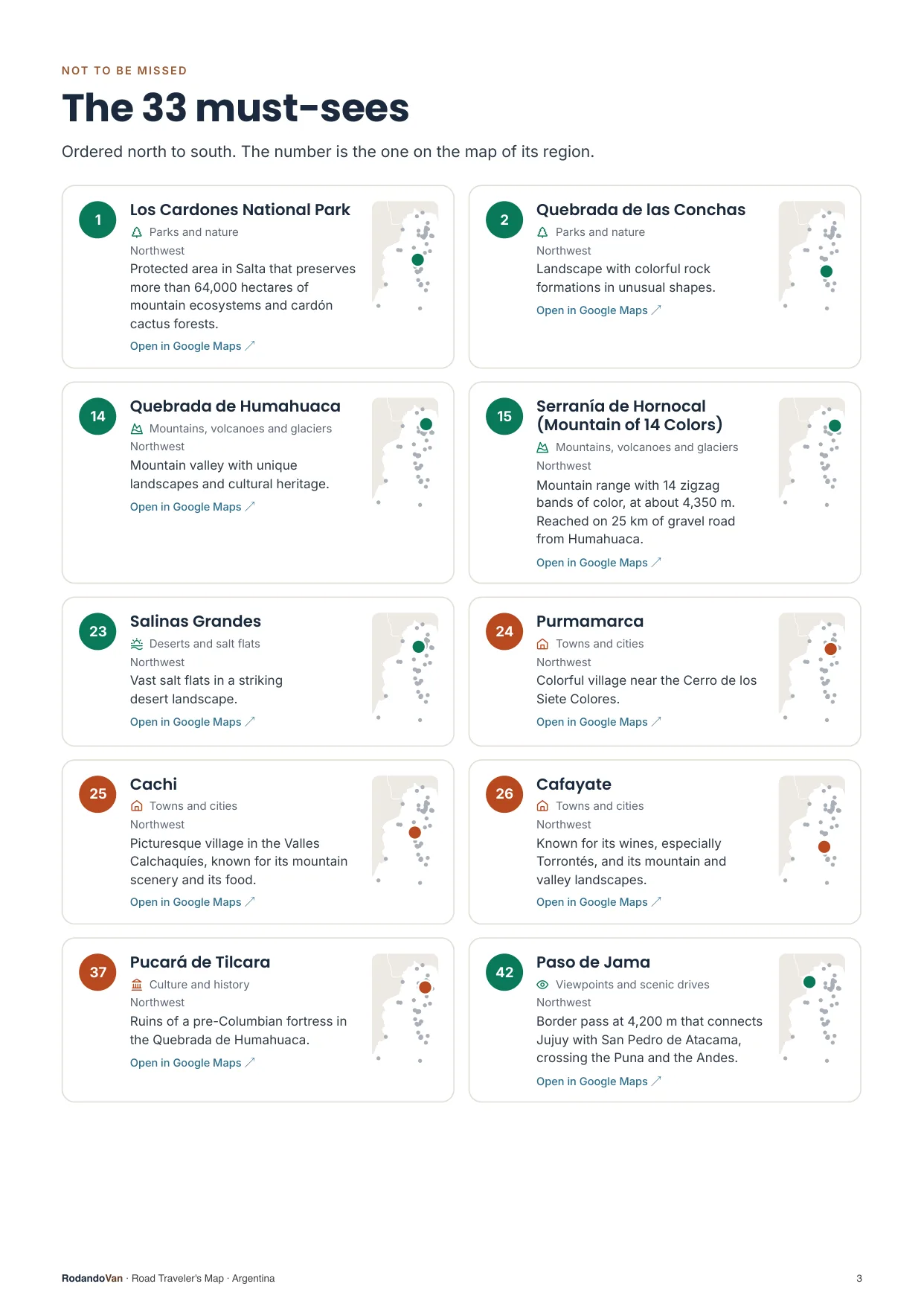
The must-sees, on cards
- What we wouldn't skip in Argentina, ordered by region.
- Each card has a small map showing where it is in its region.
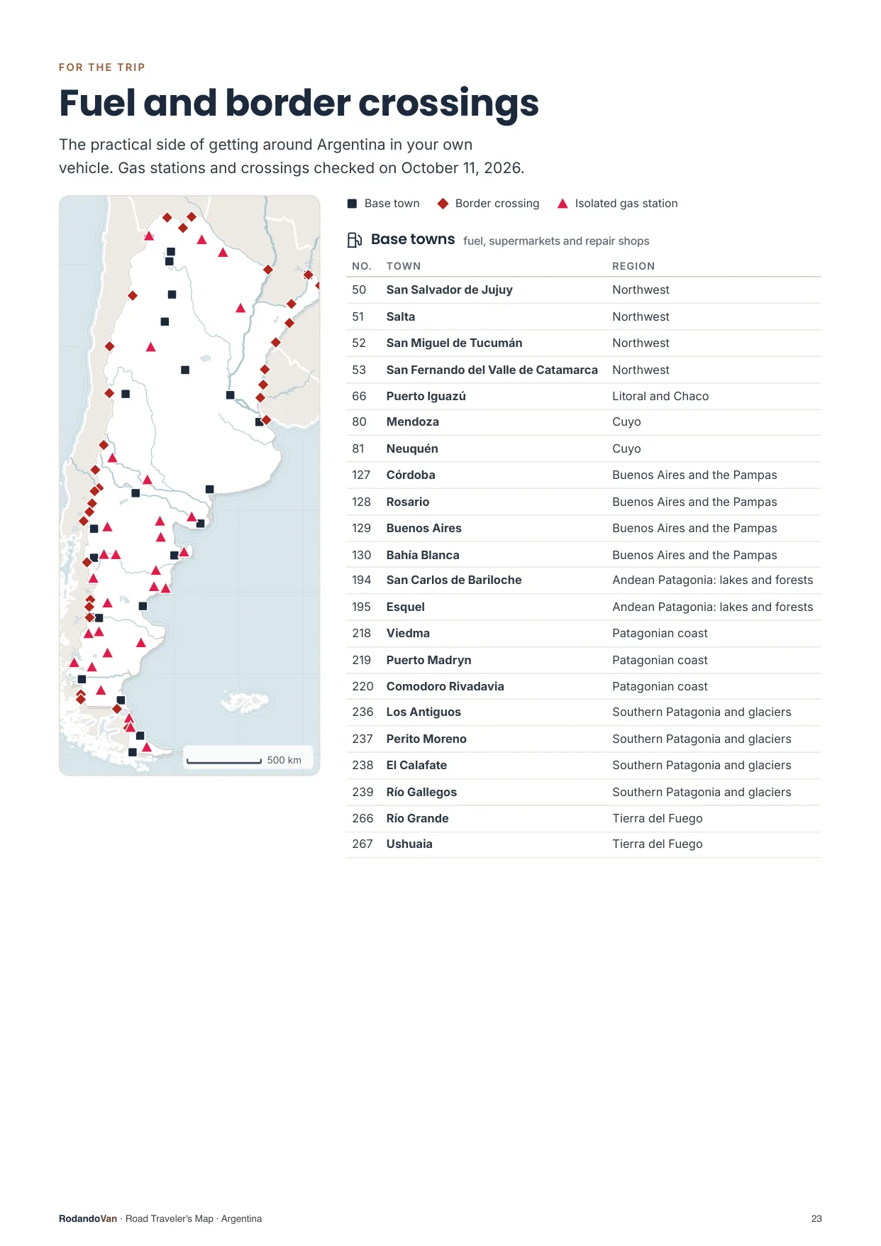
The practical side of getting around
- 22 towns to refuel, shop and find a mechanic.
- 29 gas stations with no other nearby, so you don't run short on long stretches.
- 32 border crossings with their location.
What you get
A ZIP with the map for your phone and the mini guide, ready to use offline.
- The map on your phoneAll 267 places in KML and GPX, each with its number, category and description. Works with Organic Maps and OsmAnd (offline) and with Google Maps through My Maps.KMLGPX
- 27-page mini guideA map for each region with numbered places, the must-sees on cards, ready to print.PDF
- Practical info for the tripBase towns and border crossings, on the same map. Isolated gas stations, in the mini guide.KMLPDF
- UpdatesWhen we fix or add places, you get the new version at no extra cost.
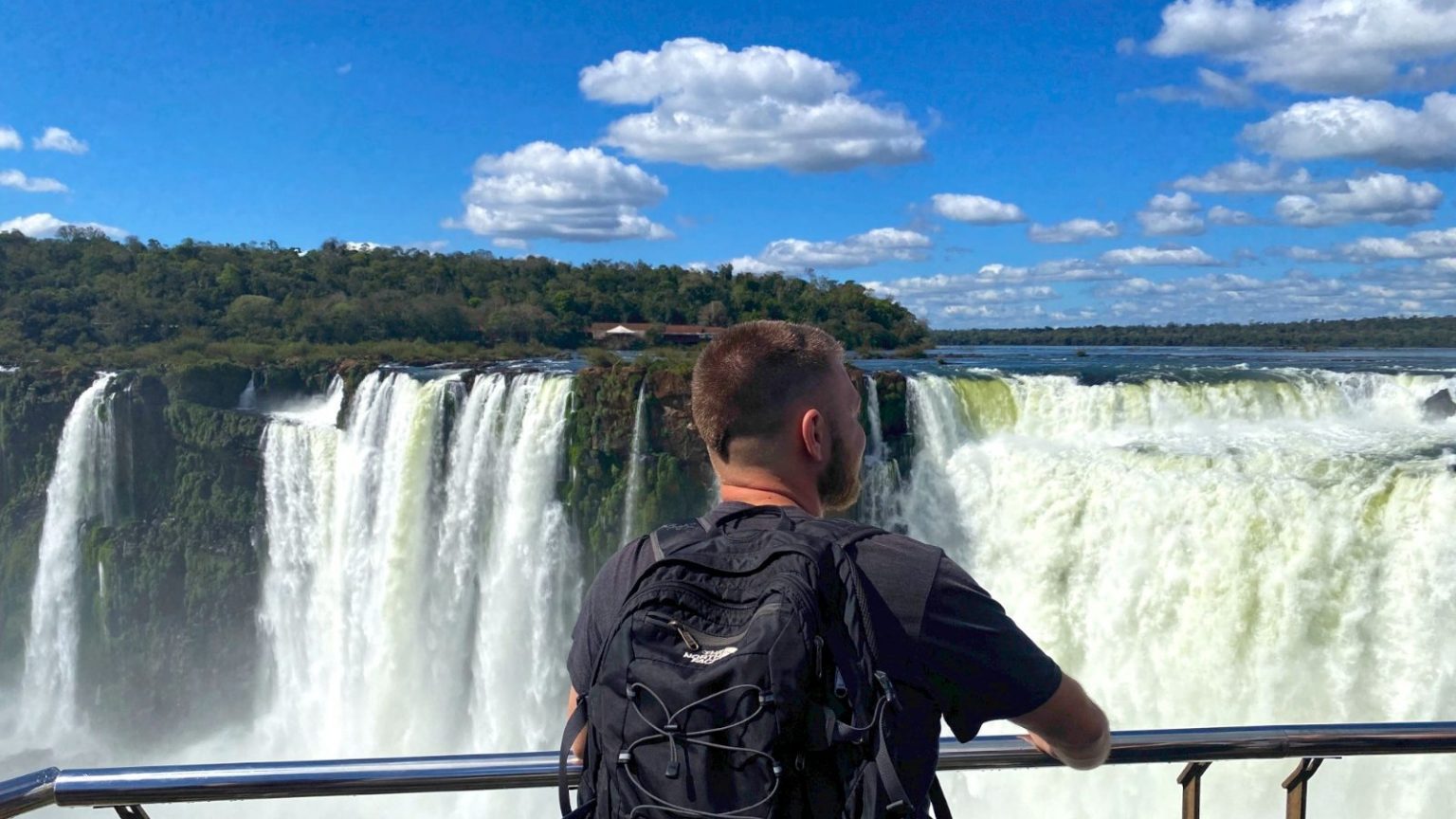
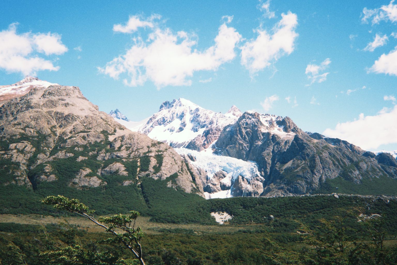
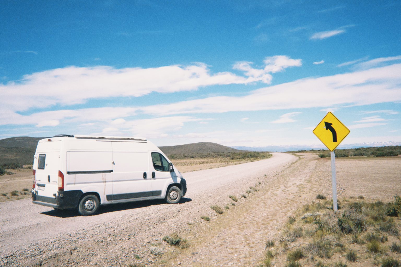
From our trip through Argentina
We put this map together while traveling through Argentina in our van, with the places we thought were worth it.
How it works
No accounts, no subscriptions.
Buy the map
Secure card payment. You'll get an email with the download link.
Load it on your phone
Open it with Organic Maps or Google Maps. The ZIP and the mini guide include instructions for each app.
Use it with no signal
Find each place by number, region or category. Use the mini guide to plan your route or print it.
Frequently asked questions
Which apps does it work with?
With Organic Maps and OsmAnd, on iPhone and Android and offline; with Gaia GPS or Locus Map; and with Google Maps, by importing the KML into Google My Maps from a computer.
Does it work with Apple Maps?
No. Apple Maps does not let you import KML or GPX files. On iPhone you can use Organic Maps, which is free and works offline, or Google Maps with My Maps.
Does it work without internet?
Yes, with Organic Maps or OsmAnd: the places are stored on your phone and you download the country map in the app. In Google Maps, maps imported with My Maps need a connection.
Have you been to every place?
No. It is our selection of places worth visiting, organized by region and described.
Where do the gas stations and border crossings come from?
The isolated gas stations come from open data, with the date they were checked. The crossings are the main ones for crossing in a vehicle, reviewed one by one, and they are on the map with the other places; the gas stations are in the mini guide. They can change: check hours and requirements before crossing.
Can I print it?
Yes, the mini guide is designed to be printed on A4, with one map per region.
How do I get updates?
We'll let you know by email and you download the new version from the same link, at no extra cost.
Are there maps of other countries?
Yes. There are maps for 10 South American countries, one by one or in a pack with all of them.
Argentina in your pocket
Everything we saved about Argentina, organized so you don't have to.
- 245 places in 8 regions, with 33 must-sees
- KML and GPX files for your phone
- 27-page mini guide with maps by region
- Practical info: 22 base towns, 29 isolated gas stations and 32 border crossings
- Free updates
