


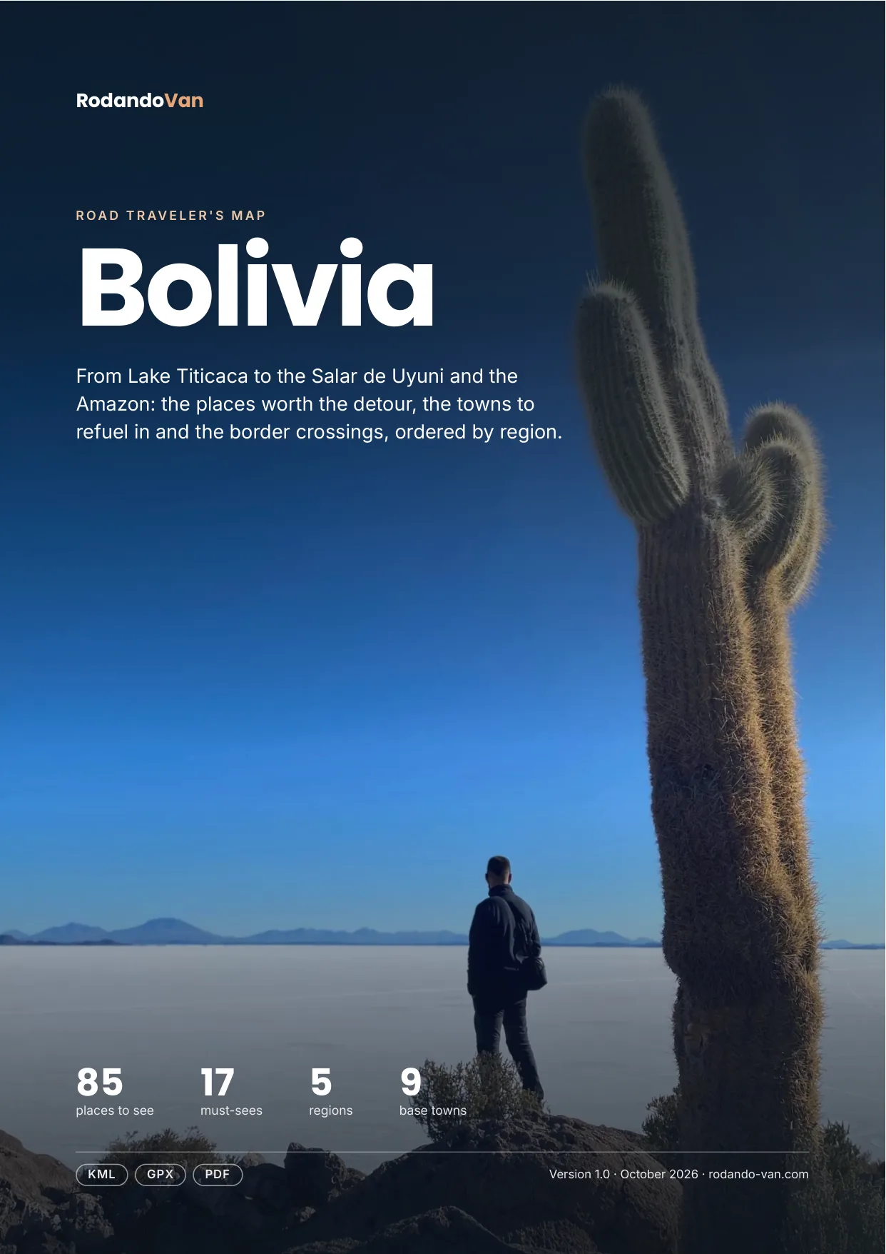
Bolivia road trip map
85 places from Lake Titicaca to the Salar de Uyuni and the Amazon, organized into 5 regions, with the towns to refuel in, the isolated gas stations and the border crossings. On your phone with no signal, and in a mini guide to plan with.
- Instant download
- Works offline
- Free updates
Explore Bolivia by region
Pick a region and tap a large dot to see that must-see.
Altiplano and Lake Titicaca
La Paz, Lake Titicaca, Tiwanaku, Oruro and Sajama.
- 7 culture and history
- 6 parks and nature
- 5 food and markets
- 4 mountains, volcanoes and glaciers
- 4 lakes, rivers and waterfalls
- 3 viewpoints and scenic drives
Must-sees in this region
- Death Road (Yungas)Road known for its scenery and biodiversity, connecting La Paz with the Yungas.
- Lake TiticacaThe highest navigable lake in the world, known for its biodiversity and Indigenous culture.
- Isla del SolMystical island considered sacred, known for its ruins and scenery.
- CopacabanaTown on the shore of Lake Titicaca, known for its shrine to the Virgin of Candelaria.
- TiwanakuPre-Inca archaeological complex declared a World Heritage Site, on the Bolivian altiplano.
Plus 30 more places in this region, each with its number on the mini guide map.
Salar de Uyuni and Sur Lípez
The salt flat, the colored lagoons, Tupiza and the route to Chile and Argentina.
- 9 parks and nature
- 5 lakes, rivers and waterfalls
- 2 beaches, coasts and islands
- 2 culture and history
- 2 base towns
- 1 hot springs
Must-sees in this region
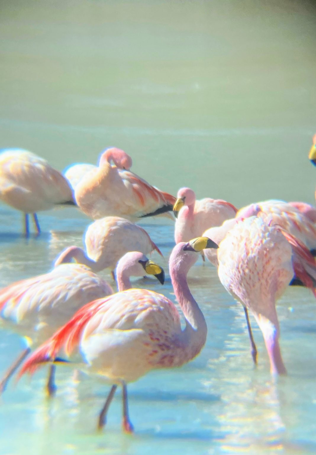
- Eduardo Avaroa Andean Fauna National ReserveReserve known for its Andean wildlife, including vicuñas and flamingos.
- Laguna ColoradaLake known for its intense red color and flamingo populations.
- Laguna VerdeEmerald lake at the foot of Licancabur Volcano, known for its unique color.
- Isla IncahuasiIsland in the middle of the Salar de Uyuni, known for its giant cacti and panoramic views.
- Salar de UyuniThe largest salt flat in the world, known for its beauty and surreal landscapes.
- Uyuni Train CemeteryHuge field of rusting locomotives on the outskirts of Uyuni, a reminder of the rise and fall of Bolivian rail transport.
Plus 17 more places in this region, each with its number on the mini guide map.
Valleys: Cochabamba, Sucre, Potosí and Tarija
Colonial cities, Torotoro and the wineries of Tarija.
- 4 base towns
- 1 parks and nature
- 1 lakes, rivers and waterfalls
- 1 towns and cities
- 1 culture and history
- 1 food and markets
Must-sees in this region
- SucreConstitutional capital of Bolivia, known for its colonial architecture and rich history.
- Villa Imperial de PotosíCity known for its mining history and colonial architecture.
Plus 7 more places in this region, each with its number on the mini guide map.
Santa Cruz and the East
Samaipata, Amboró and the Chiquitos missions.
- 5 parks and nature
- 4 lakes, rivers and waterfalls
- 4 towns and cities
- 2 culture and history
- 2 viewpoints and scenic drives
- 1 beaches, coasts and islands
Must-sees in this region
- San JavierThe first Chiquitos mission (1691), with its restored wooden church, a World Heritage Site.
- El Fuerte de SamaipataArchaeological site known for its pre-Columbian ruins and panoramic views.
Plus 19 more places in this region, each with its number on the mini guide map.
Amazon
Rurrenabaque, Madidi and the Yacuma pampas.
- 3 parks and nature
- 3 towns and cities
Must-sees in this region
- Madidi National ParkPark with some of the richest biodiversity in the world, good for ecotourism.
- RurrenabaqueTown in the Amazon, the starting point for exploring the jungle and the pampas.
Plus 4 more places in this region, each with its number on the mini guide map.
Must-seeOther place
What's on the map
94 places in 11 categories, each one a layer in your maps app.
- Parks and nature24
- Lakes, rivers and waterfalls14
- Culture and history12
- Towns and cities11
- Base towns9
- Food and markets7
- Viewpoints and scenic drives5
- Mountains, volcanoes and glaciers4
- Beaches, coasts and islands4
- Deserts and salt flats2
- Hot springs2
Inside the mini guide
17 pages with a map for each region, for your phone or to print.
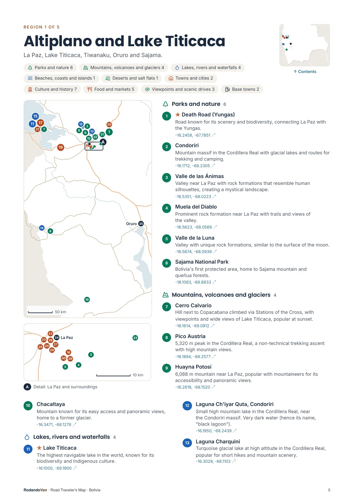
A map for each region, with every place numbered
- The number is the same on the map, in the list and in the phone file.
- Where many places are close together, a separate detail map.
- The coordinates open the place in Google Maps from the PDF.
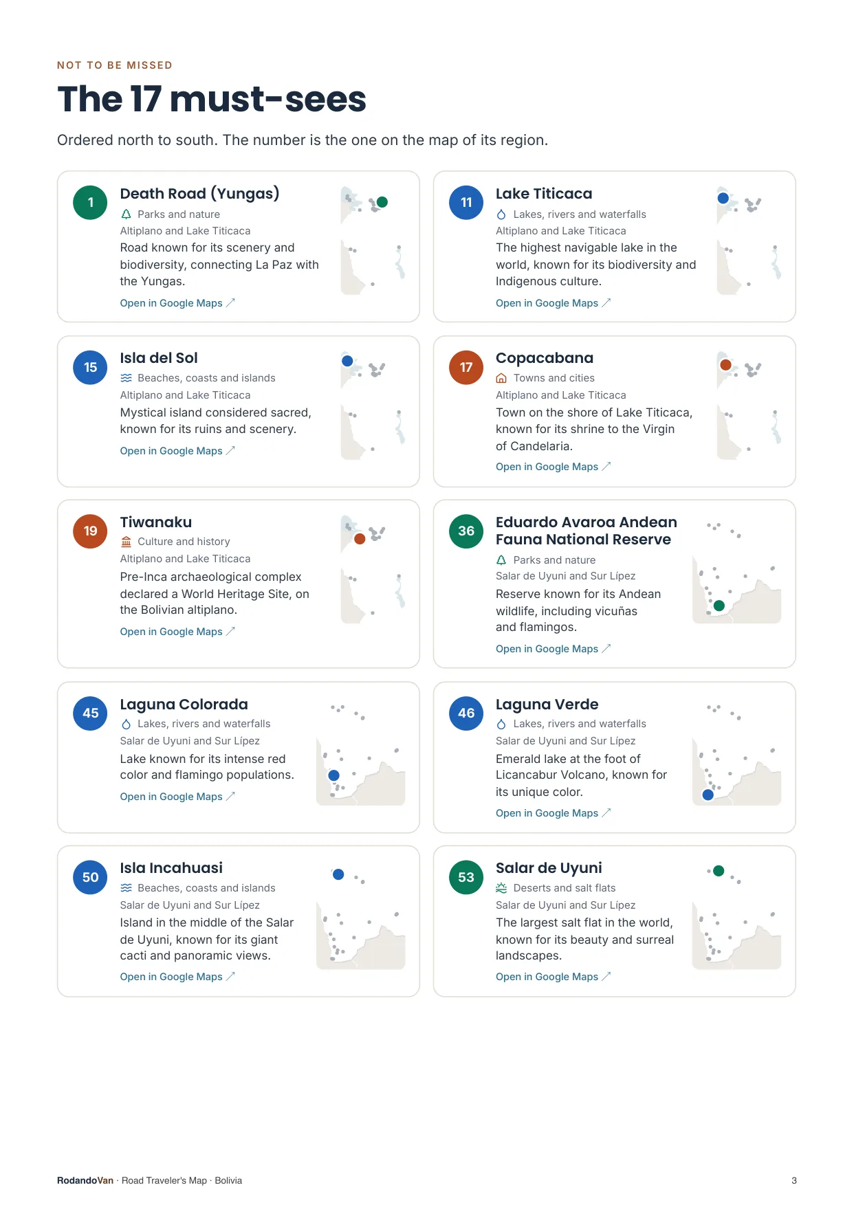
The must-sees, on cards
- What we wouldn't skip in Bolivia, ordered by region.
- Each card has a small map showing where it is in its region.
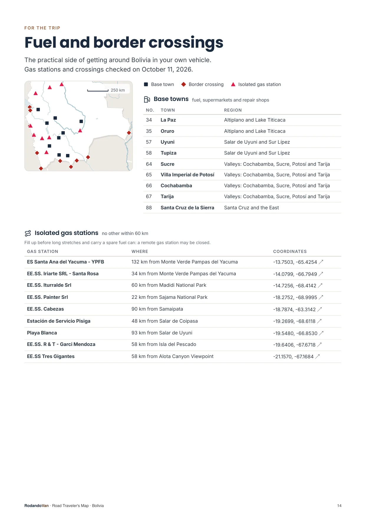
The practical side of getting around
- 9 towns to refuel, shop and find a mechanic.
- 9 gas stations with no other nearby, so you don't run short on long stretches.
- 11 border crossings with their location.
What you get
A ZIP with the map for your phone and the mini guide, ready to use offline.
- The map on your phoneAll 94 places in KML and GPX, each with its number, category and description. Works with Organic Maps and OsmAnd (offline) and with Google Maps through My Maps.KMLGPX
- 17-page mini guideA map for each region with numbered places, the must-sees on cards, ready to print.PDF
- Practical info for the tripBase towns and border crossings, on the same map. Isolated gas stations, in the mini guide.KMLPDF
- UpdatesWhen we fix or add places, you get the new version at no extra cost.


From our trip through Bolivia
We put this map together while traveling through Bolivia in our van, with the places we thought were worth it.
How it works
No accounts, no subscriptions.
Buy the map
Secure card payment. You'll get an email with the download link.
Load it on your phone
Open it with Organic Maps or Google Maps. The ZIP and the mini guide include instructions for each app.
Use it with no signal
Find each place by number, region or category. Use the mini guide to plan your route or print it.
Frequently asked questions
Which apps does it work with?
With Organic Maps and OsmAnd, on iPhone and Android and offline; with Gaia GPS or Locus Map; and with Google Maps, by importing the KML into Google My Maps from a computer.
Does it work with Apple Maps?
No. Apple Maps does not let you import KML or GPX files. On iPhone you can use Organic Maps, which is free and works offline, or Google Maps with My Maps.
Does it work without internet?
Yes, with Organic Maps or OsmAnd: the places are stored on your phone and you download the country map in the app. In Google Maps, maps imported with My Maps need a connection.
Have you been to every place?
No. It is our selection of places worth visiting, organized by region and described.
Where do the gas stations and border crossings come from?
The isolated gas stations come from open data, with the date they were checked. The crossings are the main ones for crossing in a vehicle, reviewed one by one, and they are on the map with the other places; the gas stations are in the mini guide. They can change: check hours and requirements before crossing.
Can I print it?
Yes, the mini guide is designed to be printed on A4, with one map per region.
How do I get updates?
We'll let you know by email and you download the new version from the same link, at no extra cost.
Are there maps of other countries?
Yes. There are maps for 10 South American countries, one by one or in a pack with all of them.
Bolivia in your pocket
Everything we saved about Bolivia, organized so you don't have to.
- 85 places in 5 regions, with 17 must-sees
- KML and GPX files for your phone
- 17-page mini guide with maps by region
- Practical info: 9 base towns, 9 isolated gas stations and 11 border crossings
- Free updates
