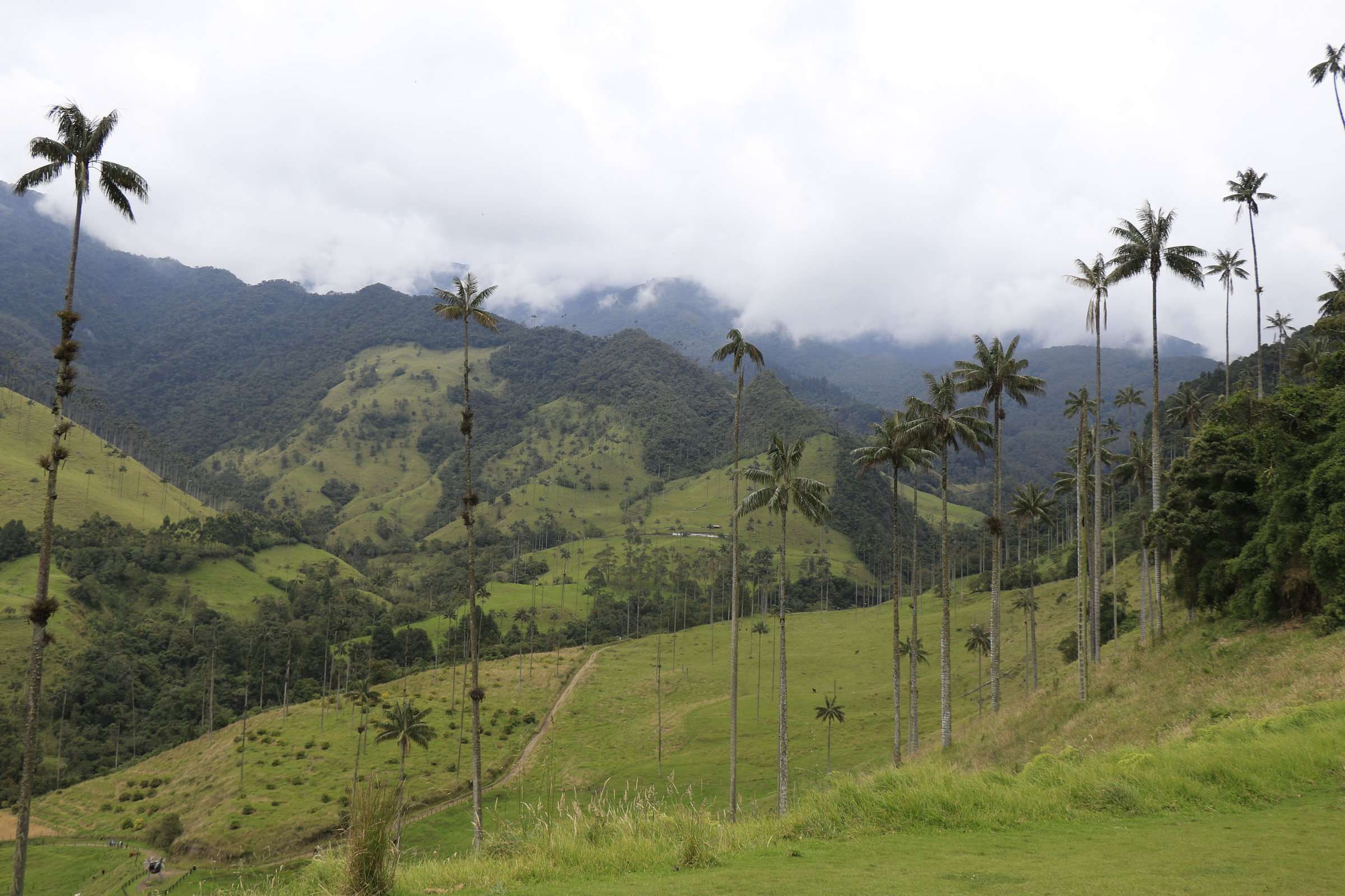


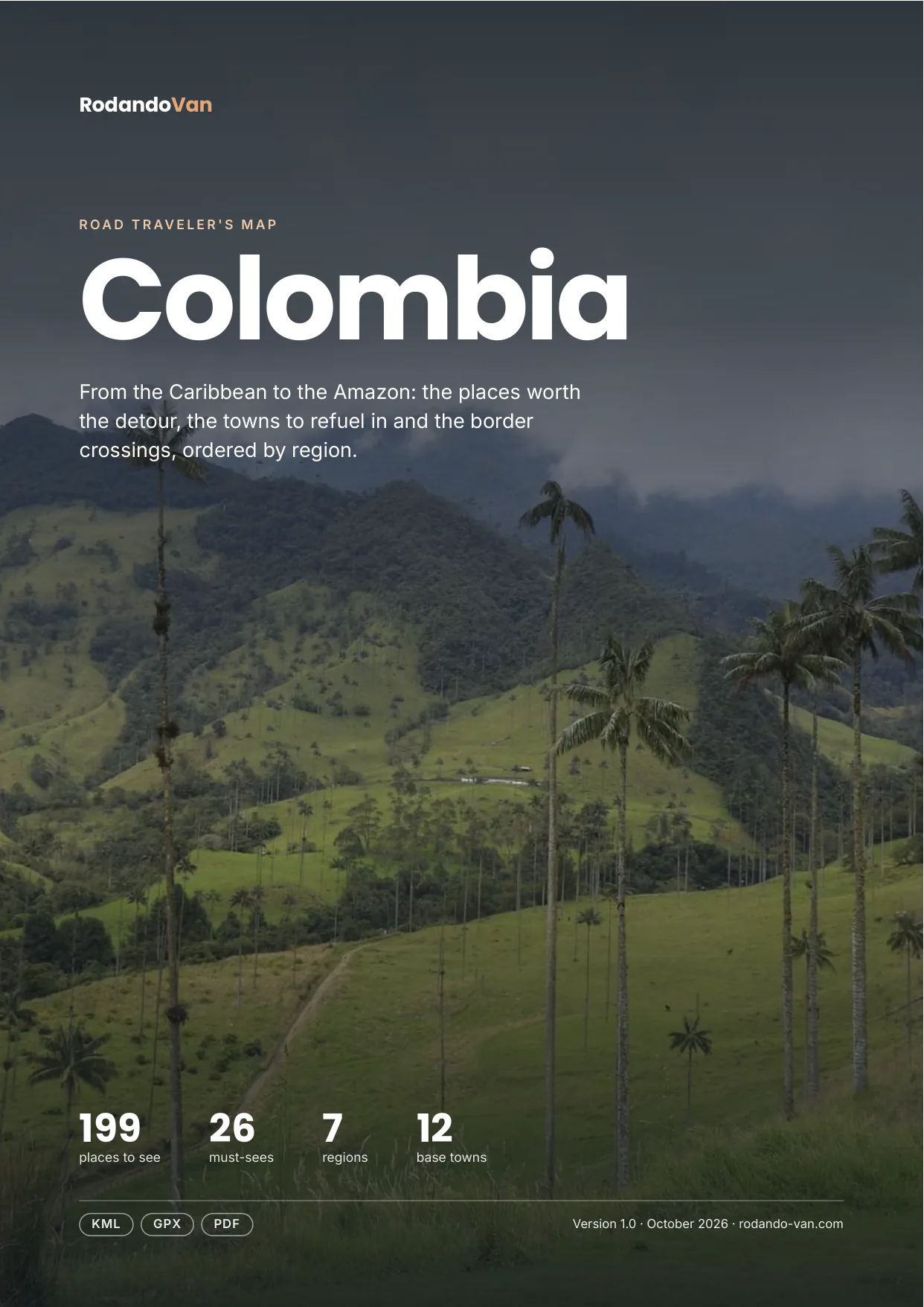
Colombia road trip map
199 places from the Caribbean to the Amazon, organized into 7 regions, with the towns to refuel in, the isolated gas stations and the border crossings. On your phone with no signal, and in a mini guide to plan with.
- Instant download
- Works offline
- Free updates
Explore Colombia by region
Pick a region and tap a large dot to see that must-see.
Caribbean
Cartagena, Santa Marta, Tayrona, La Guajira and the islands of the Gulf of Morrosquillo.
- 15 beaches, coasts and islands
- 9 towns and cities
- 6 parks and nature
- 3 base towns
- 2 lakes, rivers and waterfalls
- 2 where to sleep
Must-sees in this region
- Tayrona National Natural ParkCoastal park with beaches, trails and rich biodiversity, home to Indigenous communities.
- Ciudad PerdidaArchaeological site in the jungle, known for its ancient Indigenous cities.
- Punta GallinasThe northernmost point of the South American continent, in Wayuu La Guajira, with dunes, Caribbean cliffs and a historic lighthouse at the end of the world.
- Cabo de La VelaCoastal destination known for its desert landscapes and unspoiled beaches.
- PalominoTourist town in La Guajira with a young atmosphere, shops and artisans, a base for river activities and the beach.
- MincaMountain village 45 minutes from Santa Marta, green and cool, with waterfalls (paid entry) and a very touristy atmosphere.
- Santa Cruz de MompoxColonial town on the banks of the Magdalena, a UNESCO World Heritage Site, famous for its goldsmithing, Holy Week and intact baroque architecture.
- Santa MartaCoastal city with access to Tayrona Park and Caribbean beaches.
- CartagenaCoastal city with a colonial old town, a UNESCO World Heritage Site. A free walking tour is a good way to learn its history.
Plus 30 more places in this region, each with its number on the mini guide map.
Pacific
Nuquí, Bahía Solano and Utría: jungle, whales and beaches with no road access.
- 7 beaches, coasts and islands
- 5 towns and cities
- 3 food and markets
- 1 parks and nature
Some places in this region
- Isla GorgonaFormer prison island in the Pacific turned into a national park, home to the endemic blue lizard (Anolis gorgonae), sharks, whales and intact rainforest.
- Utría National Natural ParkNational park on the Colombian Pacific with rainforest, mangroves and wild coastline, famous for whales, biodiversity and intact nature.
- Termales ChocóConsidered one of the best villages on the Chocó Pacific coast, humble and welcoming, with spectacular sunsets.
- El ValleVillage on the Chocó Pacific coast, authentic and not very touristy; exploring its interior is recommended.
Plus 12 more places in this region, each with its number on the mini guide map.
Antioquia and the Coffee Region
Medellín, Guatapé, Jardín, Salento, the Cocora Valley and Los Nevados.
- 20 towns and cities
- 14 lakes, rivers and waterfalls
- 13 food and markets
- 11 parks and nature
- 6 viewpoints and scenic drives
- 5 culture and history
Must-sees in this region
- El Peñón de GuatapéLarge rock monolith climbed by 750 steps for panoramic views over the Guatapé reservoir.
- Los Nevados National Natural ParkMountain system with snow-capped peaks, ideal for hiking and wildlife watching.
- Valle de CocoraValley famous for its wax palms and beautiful scenery, ideal for hiking.
- GuatapéPicturesque town known for its colorful houses and the Guatapé reservoir.
- SalentoTown famous for its coffee production and Valle de Cocora.
Plus 73 more places in this region, each with its number on the mini guide map.
Bogotá, Boyacá and Santander
Bogotá, Villa de Leyva, El Cocuy, Barichara and the Chicamocha Canyon.
- 9 towns and cities
- 8 parks and nature
- 7 lakes, rivers and waterfalls
- 5 culture and history
- 5 food and markets
- 3 viewpoints and scenic drives
Must-sees in this region
- Chicamocha CanyonOne of the deepest canyons in Colombia with a cable car, paragliding and views of the Chicamocha River far below.
- El Cocuy National Natural ParkMountain park famous for its mountain landscapes and glaciers.
- MonserrateEmblematic Bogotá hill with panoramic views of the city, reached by funicular.
- Laguna de GuatavitaSacred Muisca lagoon of volcanic origin, birthplace of the El Dorado myth, surrounded by protected Andean forest.
- BaricharaColonial town with cobbled streets and traditional architecture, known for its beauty.
- San GilPopular destination for adventure sports such as rafting and paragliding.
- Villa de LeyvaColonial town with the largest cobbled main square in Colombia, marine fossils and a surprising semi-arid setting.
- ZipaquiráColonial town famous for its underground Salt Cathedral, carved into the halite mines 180 m deep.
- Gold MuseumConsidered the best museum in the country, with a complete and educational collection of pre-Columbian goldwork.
Plus 32 more places in this region, each with its number on the mini guide map.
Southwest: Cali, Popayán and Nariño
Cali, the Tatacoa Desert, Popayán, Laguna de la Cocha and Las Lajas.
- 7 lakes, rivers and waterfalls
- 6 parks and nature
- 4 base towns
- 3 viewpoints and scenic drives
- 2 culture and history
- 2 food and markets
Must-sees in this region
- Tatacoa DesertArid landscape with impressive rock formations, ideal for stargazing.
- Las Lajas SanctuaryImpressive church built over a canyon, considered one of the wonders of Colombia.
Plus 25 more places in this region, each with its number on the mini guide map.
Llanos and Amazon
Caño Cristales, La Macarena and Guaviare.
- 4 parks and nature
- 3 lakes, rivers and waterfalls
- 1 towns and cities
Must-sees in this region
- Caño CristalesRiver known for its vibrant colors, considered one of the most beautiful in the world.
Plus 7 more places in this region, each with its number on the mini guide map.
Caribbean islands
San Andrés and Providencia: by plane or boat only.
This region isn't on the map: it's far off the mainland.
- 2 beaches, coasts and islands
Some places in this region
- Providencia IslandCaribbean island known for its white sand beaches and crystal-clear water.
- San AndrésIsland known for its beaches, Afro-Colombian culture and tourism.
Must-seeOther place
What's on the map
211 places in 12 categories, each one a layer in your maps app.
- Towns and cities45
- Parks and nature36
- Lakes, rivers and waterfalls33
- Beaches, coasts and islands24
- Food and markets23
- Base towns12
- Culture and history12
- Viewpoints and scenic drives12
- Mountains, volcanoes and glaciers7
- Hot springs3
- Deserts and salt flats2
- Where to sleep2
Inside the mini guide
22 pages with a map for each region, for your phone or to print.
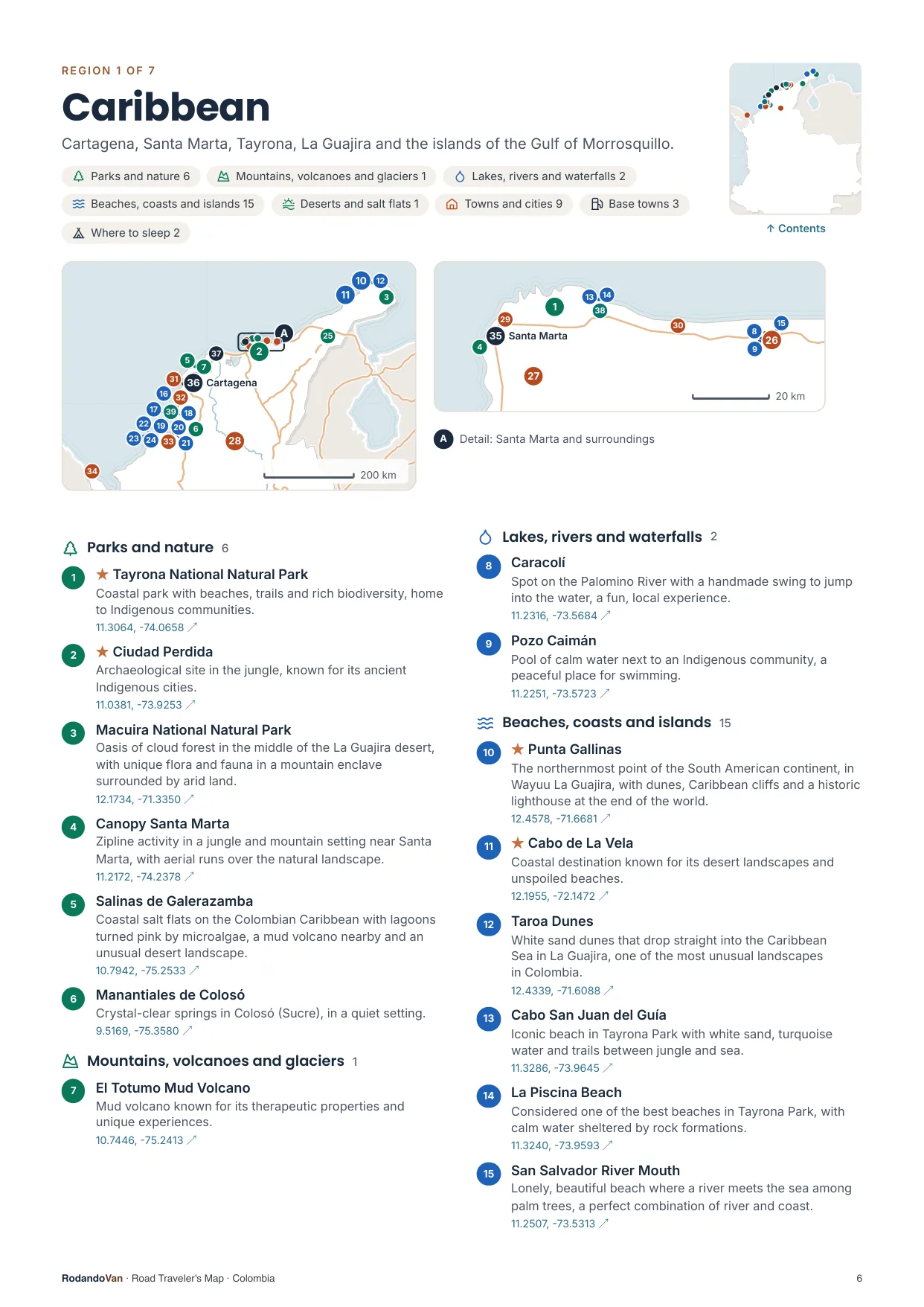
A map for each region, with every place numbered
- The number is the same on the map, in the list and in the phone file.
- Where many places are close together, a separate detail map.
- The coordinates open the place in Google Maps from the PDF.
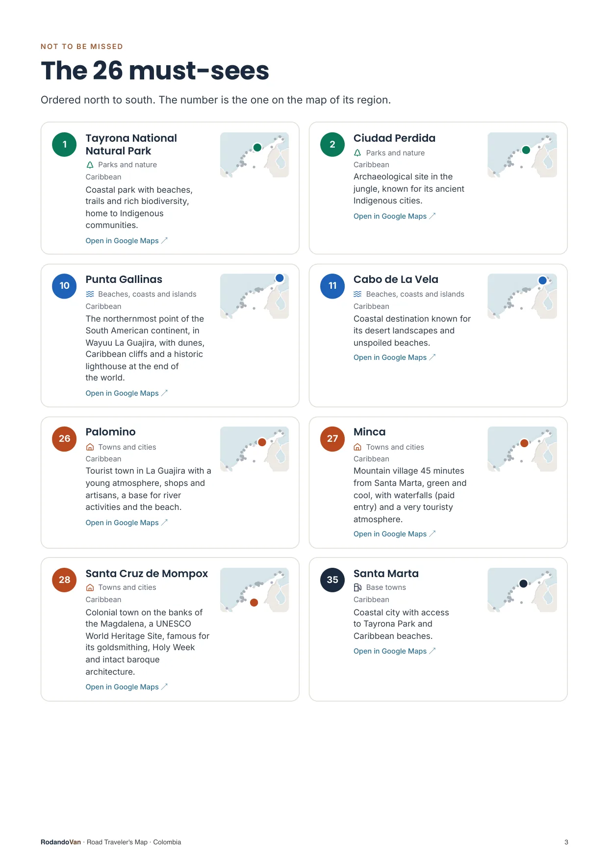
The must-sees, on cards
- What we wouldn't skip in Colombia, ordered by region.
- Each card has a small map showing where it is in its region.
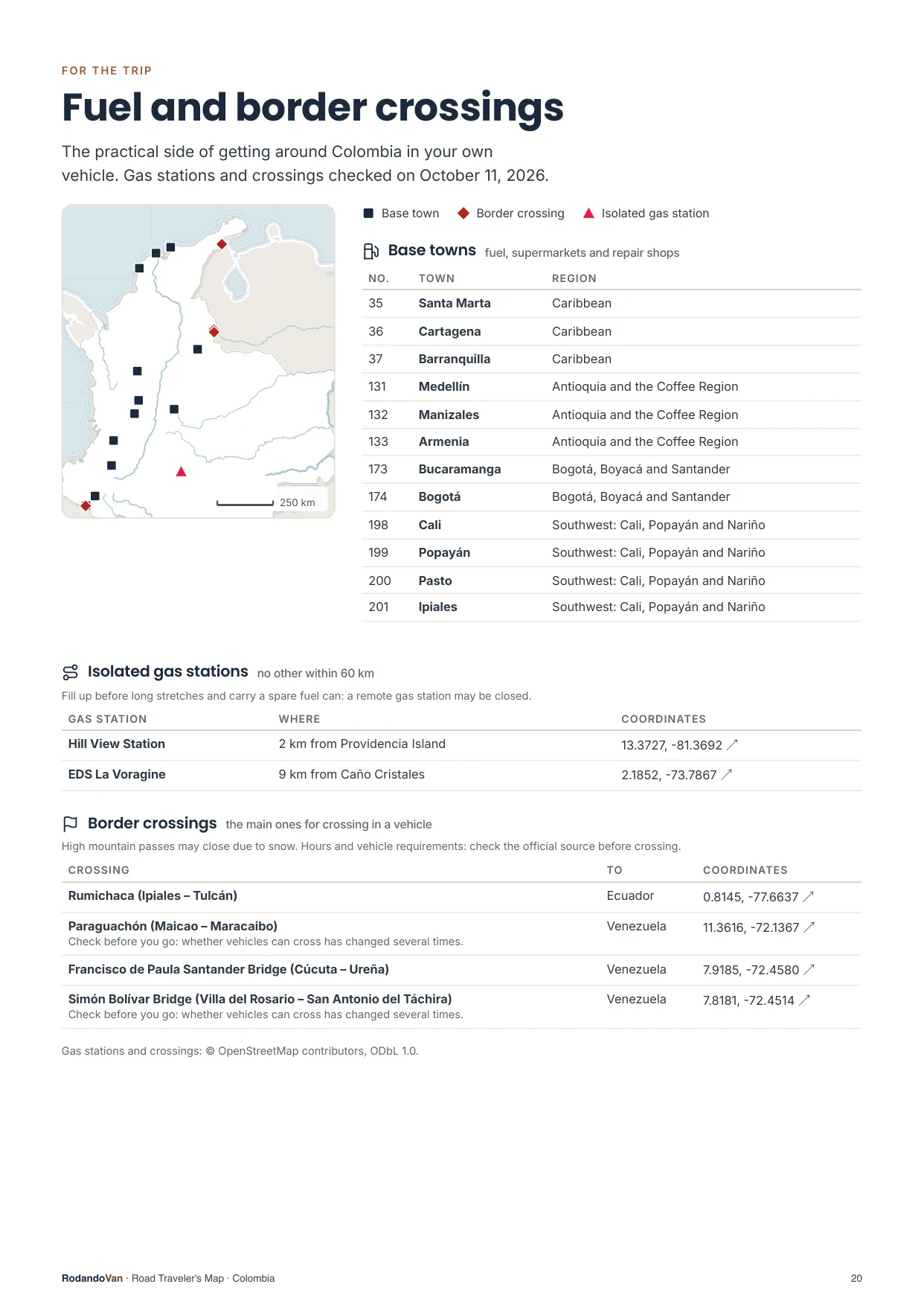
The practical side of getting around
- 12 towns to refuel, shop and find a mechanic.
- 2 gas stations with no other nearby, so you don't run short on long stretches.
- 4 border crossings with their location.
What you get
A ZIP with the map for your phone and the mini guide, ready to use offline.
- The map on your phoneAll 211 places in KML and GPX, each with its number, category and description. Works with Organic Maps and OsmAnd (offline) and with Google Maps through My Maps.KMLGPX
- 22-page mini guideA map for each region with numbered places, the must-sees on cards, ready to print.PDF
- Practical info for the tripBase towns and border crossings, on the same map. Isolated gas stations, in the mini guide.KMLPDF
- UpdatesWhen we fix or add places, you get the new version at no extra cost.

From our trip through Colombia
We put this map together while traveling through Colombia in our van, with the places we thought were worth it.
How it works
No accounts, no subscriptions.
Buy the map
Secure card payment. You'll get an email with the download link.
Load it on your phone
Open it with Organic Maps or Google Maps. The ZIP and the mini guide include instructions for each app.
Use it with no signal
Find each place by number, region or category. Use the mini guide to plan your route or print it.
Frequently asked questions
Which apps does it work with?
With Organic Maps and OsmAnd, on iPhone and Android and offline; with Gaia GPS or Locus Map; and with Google Maps, by importing the KML into Google My Maps from a computer.
Does it work with Apple Maps?
No. Apple Maps does not let you import KML or GPX files. On iPhone you can use Organic Maps, which is free and works offline, or Google Maps with My Maps.
Does it work without internet?
Yes, with Organic Maps or OsmAnd: the places are stored on your phone and you download the country map in the app. In Google Maps, maps imported with My Maps need a connection.
Have you been to every place?
No. It is our selection of places worth visiting, organized by region and described.
Where do the gas stations and border crossings come from?
The isolated gas stations come from open data, with the date they were checked. The crossings are the main ones for crossing in a vehicle, reviewed one by one, and they are on the map with the other places; the gas stations are in the mini guide. They can change: check hours and requirements before crossing.
Can I print it?
Yes, the mini guide is designed to be printed on A4, with one map per region.
How do I get updates?
We'll let you know by email and you download the new version from the same link, at no extra cost.
Are there maps of other countries?
Yes. There are maps for 10 South American countries, one by one or in a pack with all of them.
Colombia in your pocket
Everything we saved about Colombia, organized so you don't have to.
- 199 places in 7 regions, with 26 must-sees
- KML and GPX files for your phone
- 22-page mini guide with maps by region
- Practical info: 12 base towns, 2 isolated gas stations and 4 border crossings
- Free updates
