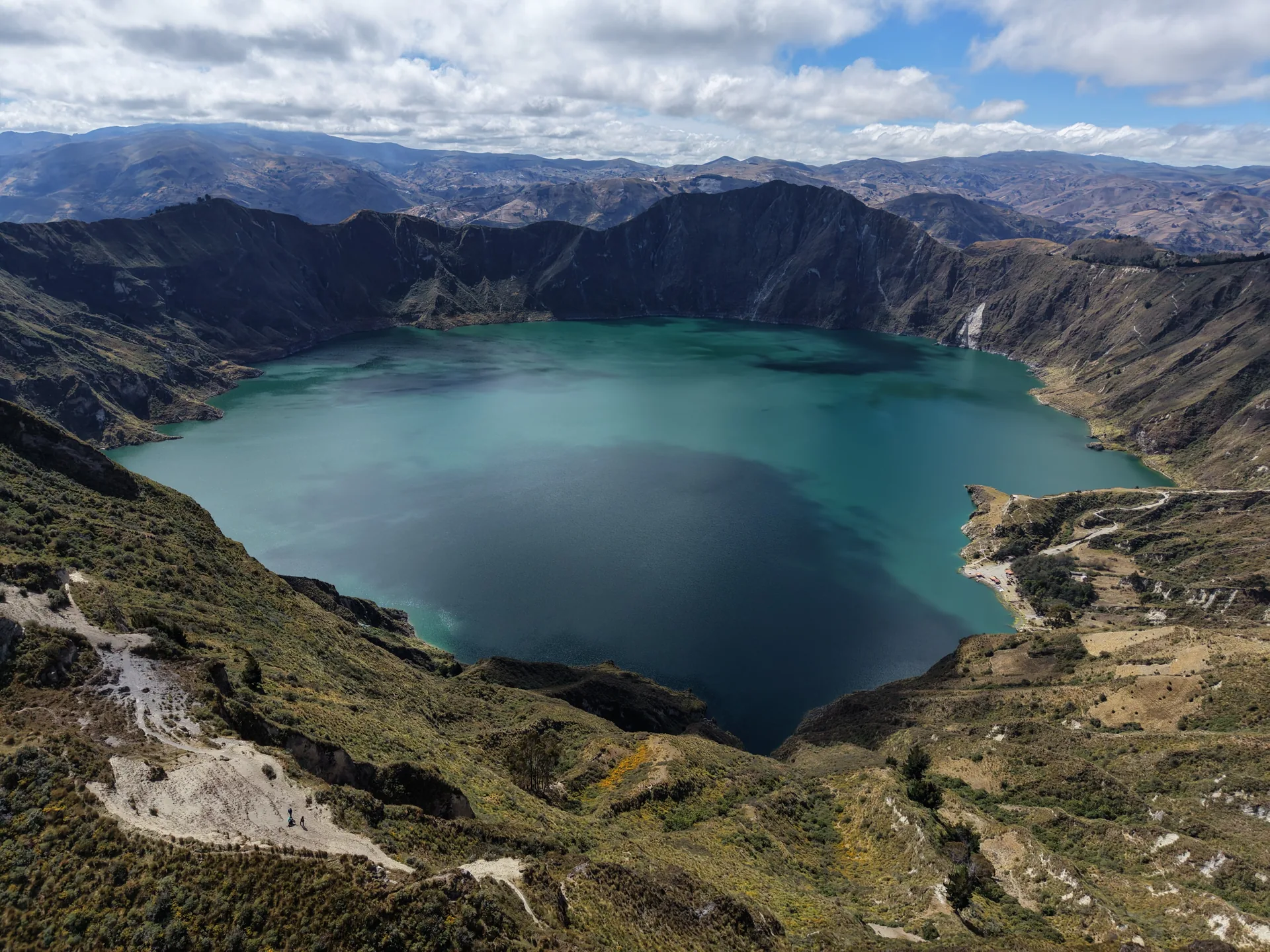


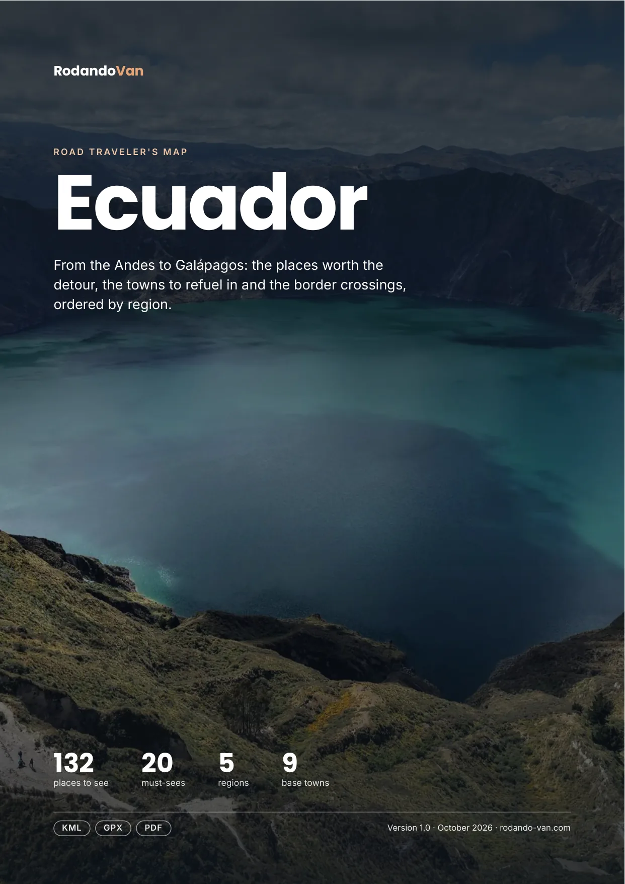
Ecuador road trip map
132 places from the Andes to Galápagos, organized into 5 regions, with the towns to refuel in, the isolated gas stations and the border crossings. On your phone with no signal, and in a mini guide to plan with.
- Instant download
- Works offline
- Free updates
Explore Ecuador by region
Pick a region and tap a large dot to see that must-see.
Northern highlands and Quito
Quito, Otavalo, Cotopaxi, Quilotoa and Mindo.
- 9 lakes, rivers and waterfalls
- 9 culture and history
- 6 parks and nature
- 6 mountains, volcanoes and glaciers
- 4 viewpoints and scenic drives
- 2 food and markets
Must-sees in this region
- Mindo ValleyArea with lush nature and adventure activities.
- CotopaxiNational park of Cotopaxi volcano (5,897 m), with Limpiopungo lagoon and the José Rivas refuge at 4,864 m.
- Laguna de CuicochaLake in a volcanic crater with two central islets, famous for its panoramic trail and deep blue water.
- Laguna del QuilotoaTurquoise lake in the crater of Quilotoa volcano, at almost 3,900 m. You can go down to the shore or walk around the crater.
- Papallacta Hot SpringsVolcanic hot springs at 3,300 m, an hour from Quito, with pools surrounded by páramo.
- Ciudad Mitad del MundoMonument to the equator line in San Antonio de Pichincha, 25 km from Quito. The actual line runs about 240 m away.
- Quito Cable CarCable car up the flank of Pichincha to 4,050 m, with panoramic views over Quito and access to páramo routes.
Plus 33 more places in this region, each with its number on the mini guide map.
Central and southern highlands
Baños, Chimborazo, Cuenca, El Cajas, Loja and Vilcabamba.
- 9 lakes, rivers and waterfalls
- 6 towns and cities
- 5 mountains, volcanoes and glaciers
- 4 base towns
- 3 viewpoints and scenic drives
- 2 parks and nature
Must-sees in this region
- Cajas National ParkHigh mountain national park with many lakes, páramo and trekking routes.
- Chimborazo VolcanoEcuador's highest peak and a challenge for mountaineers.
- El Pailón del DiabloWaterfall of about 80 m on the Verde River, near Baños, reached by a trail and passageways alongside the water.
- Baños de Agua SantaTourist destination with hot springs and waterfalls.
- VilcabambaTown with a mild climate in a valley south of Loja, known as the valley of longevity, with trails to Cerro Mandango.
- Ingapirca RuinsThe largest Inca archaeological complex in Ecuador, with the Temple of the Sun in carved stone.
- La Casa del ÁrbolTreehouse with a swing over the void, facing Tungurahua volcano, high above Baños.
- La Nariz del DiabloTrain section from Alausí that zigzags down a nose-shaped mountain. It is a short tourist ride.
Plus 25 more places in this region, each with its number on the mini guide map.
Pacific coast
The Ruta del Spondylus, Montañita, Puerto López and Guayaquil.
- 7 beaches, coasts and islands
- 6 towns and cities
- 2 parks and nature
- 1 lakes, rivers and waterfalls
- 1 base towns
Must-sees in this region
- Ruta del SpondylusRoad along the Ecuadorian coast linking beaches and towns such as Puerto López, Montañita and Olón.
- Montañita BeachBeach town with good surf waves and a backpacker and party atmosphere.
Plus 15 more places in this region, each with its number on the mini guide map.
Amazon
Cuyabeno, Yasuní, Puyo and Misahuallí.
- 8 parks and nature
- 3 lakes, rivers and waterfalls
- 2 viewpoints and scenic drives
- 2 base towns
- 1 towns and cities
- 1 culture and history
Must-sees in this region
- CuyabenoLarge wildlife reserve in the Amazon famous for its flooded lagoons, pink river dolphins and overflowing biodiversity.
- Yasuní National ParkAmazon rainforest that ranks among the most biodiverse places on the planet. Visited from lodges with a guide.
Plus 15 more places in this region, each with its number on the mini guide map.
Galápagos
The islands, 1,000 km off the coast: by plane only.
This region isn't on the map: it's far off the mainland.
- 16 beaches, coasts and islands
- 8 parks and nature
- 4 culture and history
- 3 viewpoints and scenic drives
- 1 mountains, volcanoes and glaciers
- 1 lakes, rivers and waterfalls
Must-sees in this region
- Galápagos IslandsUNESCO World Heritage volcanic archipelago with unique wildlife: giant tortoises, marine iguanas, sea lions. Reached by plane from Quito or Guayaquil.
Plus 33 more places in this region, each with its number on the mini guide map.
Must-seeOther place
What's on the map
141 places in 11 categories, each one a layer in your maps app.
- Parks and nature26
- Lakes, rivers and waterfalls23
- Beaches, coasts and islands23
- Culture and history15
- Towns and cities14
- Mountains, volcanoes and glaciers12
- Viewpoints and scenic drives12
- Base towns9
- Food and markets5
- Hot springs1
- Deserts and salt flats1
Inside the mini guide
16 pages with a map for each region, for your phone or to print.
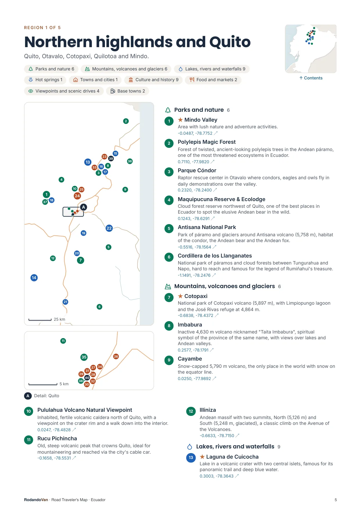
A map for each region, with every place numbered
- The number is the same on the map, in the list and in the phone file.
- Where many places are close together, a separate detail map.
- The coordinates open the place in Google Maps from the PDF.
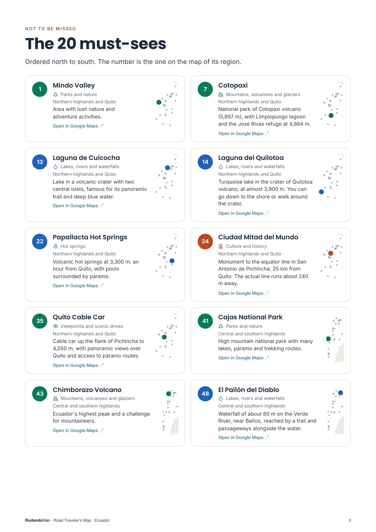
The must-sees, on cards
- What we wouldn't skip in Ecuador, ordered by region.
- Each card has a small map showing where it is in its region.
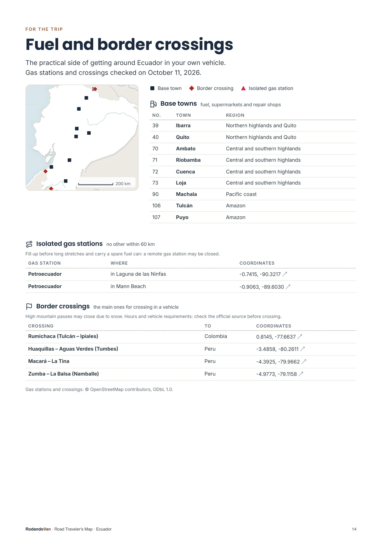
The practical side of getting around
- 9 towns to refuel, shop and find a mechanic.
- 2 gas stations with no other nearby, so you don't run short on long stretches.
- 4 border crossings with their location.
What you get
A ZIP with the map for your phone and the mini guide, ready to use offline.
- The map on your phoneAll 141 places in KML and GPX, each with its number, category and description. Works with Organic Maps and OsmAnd (offline) and with Google Maps through My Maps.KMLGPX
- 16-page mini guideA map for each region with numbered places, the must-sees on cards, ready to print.PDF
- Practical info for the tripBase towns and border crossings, on the same map. Isolated gas stations, in the mini guide.KMLPDF
- UpdatesWhen we fix or add places, you get the new version at no extra cost.
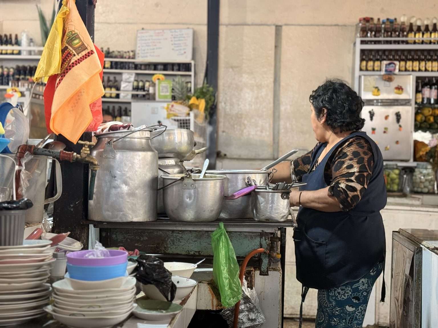
From our trip through Ecuador
We put this map together while traveling through Ecuador in our van, with the places we thought were worth it.
How it works
No accounts, no subscriptions.
Buy the map
Secure card payment. You'll get an email with the download link.
Load it on your phone
Open it with Organic Maps or Google Maps. The ZIP and the mini guide include instructions for each app.
Use it with no signal
Find each place by number, region or category. Use the mini guide to plan your route or print it.
Frequently asked questions
Which apps does it work with?
With Organic Maps and OsmAnd, on iPhone and Android and offline; with Gaia GPS or Locus Map; and with Google Maps, by importing the KML into Google My Maps from a computer.
Does it work with Apple Maps?
No. Apple Maps does not let you import KML or GPX files. On iPhone you can use Organic Maps, which is free and works offline, or Google Maps with My Maps.
Does it work without internet?
Yes, with Organic Maps or OsmAnd: the places are stored on your phone and you download the country map in the app. In Google Maps, maps imported with My Maps need a connection.
Have you been to every place?
No. It is our selection of places worth visiting, organized by region and described.
Where do the gas stations and border crossings come from?
The isolated gas stations come from open data, with the date they were checked. The crossings are the main ones for crossing in a vehicle, reviewed one by one, and they are on the map with the other places; the gas stations are in the mini guide. They can change: check hours and requirements before crossing.
Can I print it?
Yes, the mini guide is designed to be printed on A4, with one map per region.
How do I get updates?
We'll let you know by email and you download the new version from the same link, at no extra cost.
Are there maps of other countries?
Yes. There are maps for 10 South American countries, one by one or in a pack with all of them.
Ecuador in your pocket
Everything we saved about Ecuador, organized so you don't have to.
- 132 places in 5 regions, with 20 must-sees
- KML and GPX files for your phone
- 16-page mini guide with maps by region
- Practical info: 9 base towns, 2 isolated gas stations and 4 border crossings
- Free updates
