


Paraguay road trip map
27 places from the Chaco to the Jesuit missions, organized into 4 regions, with the towns to refuel in, the isolated gas stations and the border crossings. On your phone with no signal, and in a mini guide to plan with.
- Instant download
- Works offline
- Free updates
Explore Paraguay by region
Pick a region and tap a large dot to see that must-see.
Chaco
Filadelfia, the Mennonite colonies and Defensores del Chaco.
- 2 parks and nature
- 1 towns and cities
Must-sees in this region
- Paraguayan PantanalOne of the largest wetlands in the world, home to a wide variety of plants and wildlife.
Plus 2 more places in this region, each with its number on the mini guide map.
North
Cerro Corá, Laguna Blanca and the Mbaracayú forest.
- 2 parks and nature
- 1 lakes, rivers and waterfalls
- 1 beaches, coasts and islands
Some places in this region
- Cerro Corá National ParkNational park with rich biodiversity and hilly landscapes, good for hiking and wildlife watching.
- Laguna BlancaLake with clear water at 24 °C, good for swimming, surrounded by forest and white sand.
- Mbaracayú Forest Nature ReserveProtected area of Atlantic Forest, home to species such as the jaguar and the puma.
- Arroyo TagatiyáClear-water stream in the middle of the forest, little known and very picturesque.
Asunción and Cordillera
Asunción, Lake Ypacaraí, Areguá and the hills of Paraguarí.
- 3 mountains, volcanoes and glaciers
- 3 lakes, rivers and waterfalls
- 1 parks and nature
- 1 towns and cities
- 1 culture and history
- 1 food and markets
Must-sees in this region
- Ybycuí National ParkNational park known for its rich biodiversity and natural scenery, good for hiking.
- Lago YpacaraíPopular lake for recreation such as fishing and boating.
Plus 10 more places in this region, each with its number on the mini guide map.
Missions and Alto Paraná
The Jesuit missions, Encarnación, the Monday Falls and Iguazú.
- 3 culture and history
- 2 beaches, coasts and islands
- 2 towns and cities
- 2 base towns
- 1 parks and nature
- 1 lakes, rivers and waterfalls
Must-sees in this region
- Itaipú DamOne of the largest hydroelectric plants in the world, shared with Brazil. Guided tours leave from Hernandarias.
- Trinidad Jesuit MissionFormer 17th-century Jesuit mission, a World Heritage Site, with well-preserved ruins that show Guaraní-Jesuit history.
Plus 9 more places in this region, each with its number on the mini guide map.
Must-seeOther place
What's on the map
30 places in 9 categories, each one a layer in your maps app.
- Parks and nature6
- Lakes, rivers and waterfalls5
- Towns and cities4
- Culture and history4
- Beaches, coasts and islands3
- Mountains, volcanoes and glaciers3
- Base towns3
- Food and markets1
- Viewpoints and scenic drives1
Inside the mini guide
10 pages with a map for each region, for your phone or to print.
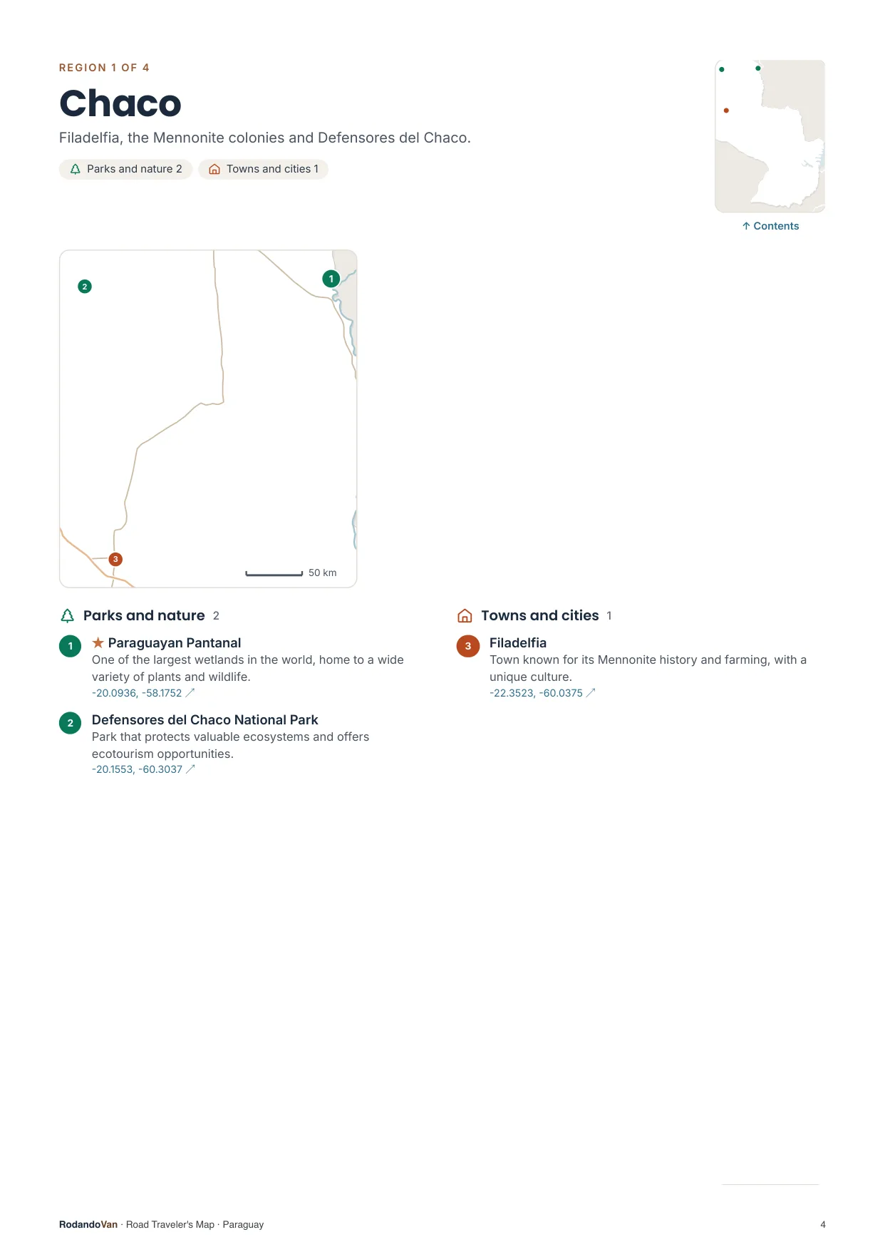
A map for each region, with every place numbered
- The number is the same on the map, in the list and in the phone file.
- Where many places are close together, a separate detail map.
- The coordinates open the place in Google Maps from the PDF.
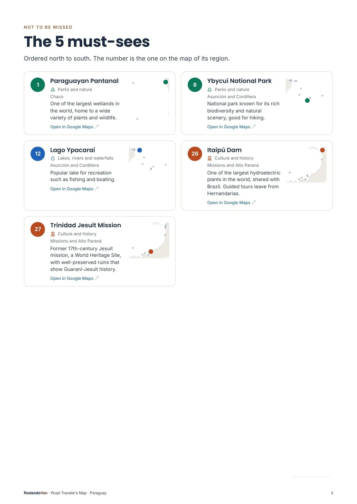
The must-sees, on cards
- What we wouldn't skip in Paraguay, ordered by region.
- Each card has a small map showing where it is in its region.
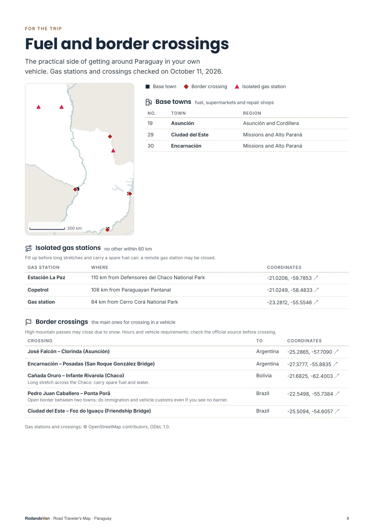
The practical side of getting around
- 3 towns to refuel, shop and find a mechanic.
- 3 gas stations with no other nearby, so you don't run short on long stretches.
- 5 border crossings with their location.
What you get
A ZIP with the map for your phone and the mini guide, ready to use offline.
- The map on your phoneAll 30 places in KML and GPX, each with its number, category and description. Works with Organic Maps and OsmAnd (offline) and with Google Maps through My Maps.KMLGPX
- 10-page mini guideA map for each region with numbered places, the must-sees on cards, ready to print.PDF
- Practical info for the tripBase towns and border crossings, on the same map. Isolated gas stations, in the mini guide.KMLPDF
- UpdatesWhen we fix or add places, you get the new version at no extra cost.


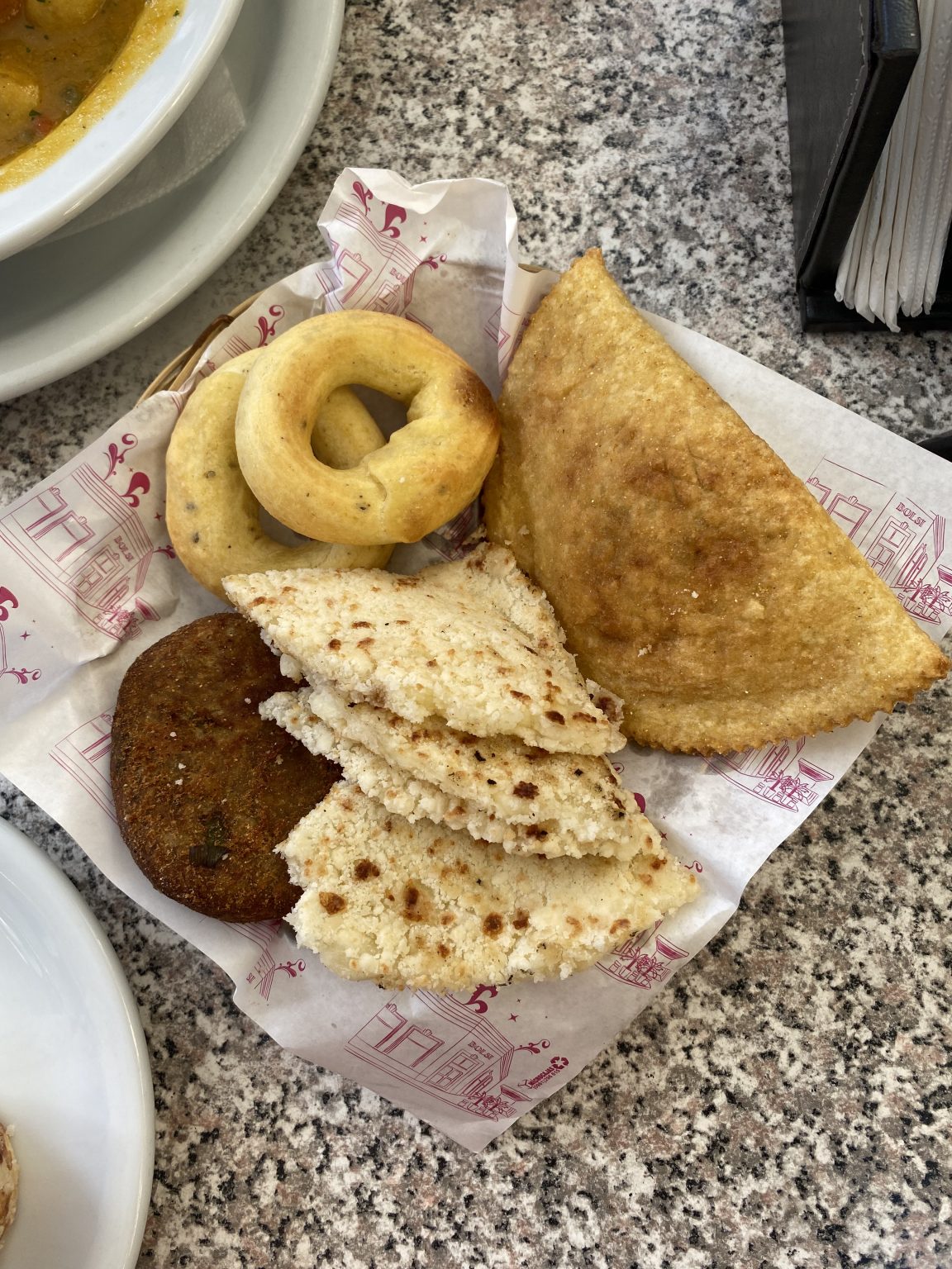
From our trip through Paraguay
We put this map together while traveling through Paraguay in our van, with the places we thought were worth it.
How it works
No accounts, no subscriptions.
Buy the map
Secure card payment. You'll get an email with the download link.
Load it on your phone
Open it with Organic Maps or Google Maps. The ZIP and the mini guide include instructions for each app.
Use it with no signal
Find each place by number, region or category. Use the mini guide to plan your route or print it.
Frequently asked questions
Which apps does it work with?
With Organic Maps and OsmAnd, on iPhone and Android and offline; with Gaia GPS or Locus Map; and with Google Maps, by importing the KML into Google My Maps from a computer.
Does it work with Apple Maps?
No. Apple Maps does not let you import KML or GPX files. On iPhone you can use Organic Maps, which is free and works offline, or Google Maps with My Maps.
Does it work without internet?
Yes, with Organic Maps or OsmAnd: the places are stored on your phone and you download the country map in the app. In Google Maps, maps imported with My Maps need a connection.
Have you been to every place?
No. It is our selection of places worth visiting, organized by region and described.
Where do the gas stations and border crossings come from?
The isolated gas stations come from open data, with the date they were checked. The crossings are the main ones for crossing in a vehicle, reviewed one by one, and they are on the map with the other places; the gas stations are in the mini guide. They can change: check hours and requirements before crossing.
Can I print it?
Yes, the mini guide is designed to be printed on A4, with one map per region.
How do I get updates?
We'll let you know by email and you download the new version from the same link, at no extra cost.
Are there maps of other countries?
Yes. There are maps for 10 South American countries, one by one or in a pack with all of them.
Paraguay in your pocket
Everything we saved about Paraguay, organized so you don't have to.
- 27 places in 4 regions, with 5 must-sees
- KML and GPX files for your phone
- 10-page mini guide with maps by region
- Practical info: 3 base towns, 3 isolated gas stations and 5 border crossings
- Free updates
